Submitted by the Petrochem Appeal Alliance
11/18/19
Members of the Petrochem Appeal Alliance:
Climate First: Replacing Oil and Gas (CFROG), Environmental Coalition of Ventura County, Food and Water Action (FWA), Ventura Citizens for Hillside Preservation (VCHP), Friends of the Ventura River, Ventura Land Trust, Wishtoyo Chumash Foundation, California Trout, Inc., Sierra Club (Los Padres Chapter), Westside Community Council (WCC), Showing Up for Racial Justice (SURJ-VC), Unitarian Universalist Church of Ventura (UUV), Central Coast Alliance for a Sustainable Economy (CAUSE)
Sespe consulting submitted a project application and description on 9/1/16, and county staff completed an initial study and an MND based on that permit request. Subsequent to that study being completed, including the environmental review and the conditions of the permit, the applicant made substantive changes to their project application and project description. Just prior to the planning director hearing, all references to the Port of Hueneme were deleted from the permit leaving only the remaining words, “transportation storage yard for passenger vehicles” in this portion of the project description.
The importance of removing the Port from the project description is great. Ventura County only has one Port through which new vehicles are imported. The Port has made it clear that neither the Port or any of its customer dealerships will utilize this site or project. The applicant has not submitted an alternative use. In Applicant’s haste to get approval for the project permit, reference to Port Hueneme was removed. In reality, this removal has also removed the potential for receiving new vehicles. Therefore, the activities described in the application of removing shipping wraps from new vehicles, and preparing them for delivery to dealerships throughout Ventura County will not occur.
The failure to submit a full, true and correct form raises multiple reasons for denial of this permit, as detailed below.
1) The application submitted by Sespe Consulting on behalf of the applicant on September 1, 2016, and which served as the full and complete information required for the Initial Study and subsequent MND, was not submitted in a full, true, and correct form. Therefore, applicant has violatedNCZO 8111-2.1 Sec. 8111-2.1.(“Submission of Applications, Application requests shall be filed with the Planning Division. No application request shall be accepted for filing and processing unless it conforms to the requirements of this Chapter; contains in a full, true and correct form the required materials and information prescribed by the forms supplied by the Ventura County Planning Division.)
In this circumstance, the application must be returned to the applicant for revisions such that it can be accepted as complete in full, true and correct form in order that a true, full and accurate EIR or MNDcan be conducted based upon accurate information and data. In addition, resubmittal is required to allow for the public right to comment. Instead, the project description was substantively amended prior to the Planning Director Hearing, and those changes were first revealed to the public at the hearing.
Full, true and correct information must be sufficiently detailed to provide limits for impact analysis. As written, the project description is aimed at preserving a wide range of development options, and lacks the technical characteristics such as building plans indicating areas of use, and elevations required in a project proposal. Currently the description only presents concepts and impact generalities which create an obstacle to informed public participation, as well as an informed decision-making process. This lack of specificity is also a violation of CEQA.
2) The planning director’s decision to grant PL16-0118 is an abuse of discretion because the project description is not accurate, finite, or stable as required by CEQA. The MND should be remanded to the planning department for an adequate CEQA review based upon a true, accurate, finite, and stable project description.
The transportation service yard will not be receiving cars from Port Hueneme for storage, prep work and transportation to Ventura County dealers as was stated in the application. Port officials have publicly stated that neither the Port or any of its customer dealerships are interested in the future use of this site or permit. It is not clear what, if anything, this part of the project will now become. Therefore, the air quality analysis, based upon 20 associated truck-loads of cars per day, each truck traveling 22 miles from the Port to the site as stated in the air quality analysis, is useless because the assumptions used to calculate the emissions are incorrect.
In fact, there is no way to determine what the use will become, and attempting to use the limits of permit conditions to control the project impacts is an obstacle to public participation and informed decision-making.
The impacts of the project need to be determined through the CEQA process in order for the permit conditions to be formulated, not the other way around. For the same reasons, the biology assessment is inadequate. Finally, the transportation study done by DUDEK cannot include the details necessary for an accurate analysis because there is not a stable or finite project to analyze.
The project description is usually a brief description of a story that develops during the EIR process, explaining why the project actions or activities may or may not have an effect on the environment. Without a complete and stable project description the planner preparing the impact analyses does not have the information necessary to determine what impacts the proposed project may have, or the intensity of those impacts. The Initial Study cannot be accurately done if the project is not finite or accurate. In this case, the project description changed overnight from being a transportation service yard for new cars imported through the Port of Hueneme to a transportation service yard for passenger vehicles. We only have one Port, where will the vehicles come from? Or will new vehicles come at all? Might it become a junk yard where wrecked and damaged passenger vehicles are parted out for sale? What are the environmental impacts of that major change in the project description?
3) The MND did not include a description of the facilities with plans and elevations that show the impacts of the new project. The planning director discovered the MND lacked building plans after the planning director hearing, and included the plans as required by CEQA in an errata. The late addition of these essential parts of a project’s character left the public out of this necessary part of CEQA review.
Essential characteristics of a project such as building plans and elevations cannot be added as an errata. As added, the plans have not been altered or updated from their original 1950’s design as a chemical plant. This is further evidence that the applicant has no more than a vague idea of what the project might be in its actual implementation phase. The permit for this project is now aimed at preserving a wide range of development options, and for this precise reason it must be sufficiently detailed to provide limits for impact analysis.
Failure in a project proposal to present technical characteristics, such as building plans indicating areas of use and elevations, and instead presenting concepts and impact generalities is an obstacle to public participation, to an informed decision-making process, and a violation of CEQA.
4) The contractor’s storage yard has a sub-component that has the potential to significantly harm the environment in the form of noise, vibration, air quality and increased traffic. The project description contains one sentence: “Vehicle parking will be available on the project site for trucking companies and municipalities”. There is no further reference to this use beyond this one sentence in the entire CEQA review. The DUDEK traffic study did not include the potential impacts of this use because it has not been quantified or explained. There is no mention of this permitted use in the chart listing truck trip maximums. Thus, there may be no maximum daily trips for this intended use. Any vehicle that is parked at the site must be driven in and out, therefore, this use requires quantification.
Since the site will be open 24 hours a day, could the site be used as a short-term truck driver rest area? If not, why not? If so, what is the impact of generator noise and vibration or refrigerator tractor trailers running in early morning hours? What might the impact of trucks coming and going all day and night be to the surrounding neighborhood, sensitive habitats, and the bike path? Since this impact was not explained or evaluated in any way, and was not included in the initial study, the MND cannot be approved.
There is no recognition or accounting of the emissions from cold-start of vehicles as they are removed from the auto transport trucks to temporary parking locations, from parking locations to detail and prep locations on property, again back to parking locations, then again back onto another transport vehicle for distribution to auto dealerships. Cold-start emissions are substantially higher than running emissions and need to be accounted as such.
In addition, with the Port now out of the picture, it begs for detail on who would be the client for auto storage. The next most logical candidate would be used vehicle dealerships. That would mean that instead of brand new low-emission vehicles, there would be a mix of older more polluting vehicles and new vehicles that would otherwise be stored at dealerships. The same pattern of at least four short cold-start trips (as described above) but including older cars in the mix would increase emissions.
Sespe also fails to include reference to any stationary or portable equipment. This omission lacks credibility with respect to the proposed uses. Where are the fork lifts? Where is the equipment used for auto prepping? These would be stationary or portable equipment with associated emissions. Similarly, it is not credible that all contractor/employee trips would be with light duty vehicles. In the contractor storage area there would be pieces of equipment that would be brought in by heavy-duty diesel trucks with much higher emissions. The equipment to be stored would then be cold-started to park, and again cold-started to be returned to a heavy-duty diesel to return to service.
The transportation study conducted by DUDEK is based upon inaccurate and unstable information supplied by the applicant and therefore is not a reliable source of impact analysis for the MND. The application includes this inaccurate truck traffic data:
“Transportation Services (Vehicle Holding Lot): New vehicles will be delivered from Port Hueneme harbor to the site (approximately 20 miles one way) via large, auto transporter trucks (Heavy-Duty Trucks).New vehicles will also periodically be loaded onsite and delivered to dealerships throughout Ventura County. As such, each load is assumed to result in two trips (1 inbound and 1outbound). Additionally, two (2) employees will be stationed onsite to assist with the Transportation Services/Vehicle Holding Lot operations. Each worker is assumed to make one round trip (2 ADT) per day to the site in their own personal vehicles (Light-Duty Trucks).
For auto transporter trucks, it is anticipated that an average of 10 loads of new vehicles (20 ADT) will be delivered to and/or transferred from the site each day. During peak days, it is assumed that up to 20 loads (40 ADT) may occur. For employee vehicles, each employee is assumed to make one round trip (2 ADT) per day to the site. During peak days, it is assumed that up to four (4 ADT) employee trips per day may occur.”
This inaccurate description of the use has led to a baseless analysis of air, noise and traffic impacts.
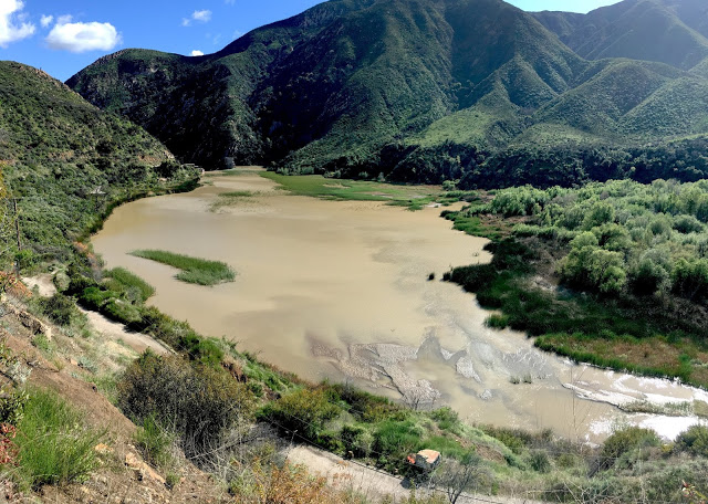
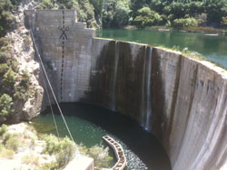
5) The MND fails to include all relevant responsible agencies, and impacts of great environmental concern. Both the National Oceanographic and Atmospheric Association (NOAA), and the National Marine Fisheries Service (NMFS) have a direct interest in the impact this project might have on the Southern California Steelhead Trout, which would be negatively impacted from sediment entering the Ventura River.
The MND provides evidence that the property will flood and enter the river habitat. The applicant has included riverine protection from cars, trucks, boats, and building materials floating towards the river, and being stopped in their tracks by “bollards” being placed on the western edge of the property. The applicant is admitting that flooding will occur on this property, however, the bollards and the sediment ponds will not stop flood waters from entering the river habitat. These flood waters will be laden with sediments and other soluble material that can cover steelhead redds (gravel nests) and destroy the alevins (baby steelhead) by the hundreds in Critical Habitat designated by NMFS. Killing Steelhead, at any stage of its life cycle is called “a taking”, and is punishable by Federal law.
This is a significant adverse impact on the environment and a clear violation of the Endangered Species Act. The MND does not address this impact, nor provide mitigations.
In addition, the impact of this project on the lower reach of the Ventura river in terms of in-stream flow volume, and water quality over a range of precipitation conditions is unknown. Various agencies already told the Ojai Sanitary district that they cannot allow re-use of effluent being discharged into the river because of its role in habitat preservation. This project is a massive reduction in infiltration during high rain events which may affect year round stream flow by reducing lower river aquifer re-charge.
Also to be considered: The certified biologist reports cited in the 2017/2018 Petrochem PDP application occurred during a prolonged local drought period, meaning that site examinations for such species as the California Red Legged Frog (CRLF) may be inaccurate in that the prolonged drought conditions may have dried up surface wetland areas that normally provide habitat for different protected plant and animal species. The Ventura River and its Canada Larga Creek and Manuel Canyon Creek tributaries are known to offer habitat area for the CRLF and other protected species. Given that the project site is located such that the Ventura River is adjacent to the west, the Canada tributary to the north and the Manuel tributary to the south it is easy to see that under normal rainfall conditions the project site might host important sensitive habitat for various animal and plant species.
The Ventura County Wildlife Corridor runs adjacent to the property in question. How will the proposed use affect this sensitive habitat area? The failure of required specificity in the application makes it impossible to assess its impact on habitat connectivity and wildlife movement.
6) Although this appeal argues that there is insufficient information to do a credible environmental review, even a ‘best case’ assessment based on the broad outline provided in the application would violate the 25LB/day air emissions limitation set by the County.Further, appellants strenuously contest the claim that this property, bounded by the Ojai Valley Area Plan air emissions standard of 5LB/day, should be carved out. This ‘gerry-mandering’ of the air emissions boundaries is questionable as a legal matter, and contrary to science and changed circumstances in the airshed.
7) If the Planning Director’s decision is considered an entitlement, it must be nullified per NCZO 8111-2.7. This section requires that “zoning clearances and all licenses issued there and all other entitlements shall be null and void for any of the following causes: (a), the application request which was submitted was not in full, true and correct form.” The entitlement should be nullified because it was issued erroneously.
The grounds for nullification are that the application has not submitted a full, true and correct form. The application did not say that the applicant was hopingto contact the Port of Hueneme to enter a contract to provide storage and prep for new cars. Rather the application said, “The Applicant is proposing to utilize an approximate 19 acre area of the site for a Transportation Services/Vehicle Holding Lot. Ventura County receives large shipments of vehicles for retail dealers at the Port Hueneme harbor. The proposed Transportation Services/Vehicle Holding Lot will allow for the short-term storage of passenger vehicles before they are delivered to various auto dealerships in Ventura County. The cars are offloaded at the Port Hueneme harbor and would be delivered to the site via auto transporter trucks. They will be stored on the Holding Lot for approximately fourteen to ninety days depending on market conditions. Prior to leaving the site, most vehicles will be prepared to be delivered to the dealerships by removing transportation packaging, rinsing, adding floor mats and off the shelf parts.”
In fact, the Port had no knowledge of the Applicant’s scheme. Applicant’s misleading and false application is cause for nullification.
8) The Project does not have legally clear parcels for the project.
In the Attachment 1– Response to Public Comments PDF on Page 33 of 126 the City of Ventura’s Jan 13, 2017 letter re: the County of Ventura New Project Referral Form for the Petrochem Planned Development Permit illuminates several important points regarding the Petrochem Project’s lot parcels. Certain of these projected claimed parcels are city-owned with railroad right of way easements. This challenges the project’s legal lots claim as well as the claim to compliance with existing City/County General Plan designations and policies.
The city letter states that parcels APN 063-0-120-015 and 063-050-145 were historically designated “Agricultural” during the general re-designation of parcels located within the floodplain sometime in the 80’s prior to SOAR, and were carried over to the 1989 Comprehensive Plan as “Agricultural” parcels and are therefore subject to the 1995 City SOAR and now in the 2005 General Plan will require compliance with the City SOAR initiative as amended by voters Nov. 8, 2016.
Additionally, the city letter goes on to explain that parcels APN 063-0-120-020 and 063-0-050-320 are CITY-OWNED parcels that retain a Railroad Right of Way easement over them. Both parcels have a Parks and Open Space designation within the City of Ventura 2005 General Plan land use diagram because of the Ventura/Ojai Bike Trail. Both are located within the City’s current Sphere of Influence (SOI). Because of the historic use of the Petrochem site, the trail was shifted toward the eastern bank of the Ventura River. Much like the Agricultural properties, the city of Ventura will evaluate for realignment of the open space designation at the time of a major development proposal and annexation, where General Plan designation may be reevaluated for alignment during city review.
9) The project is not in compliance with the City of Ventura’s 2005 General Plan. The County and City have a joint North Ventura Avenue Plan included in both the City and County General Plans. The City Staff letter points out on page 36 of 126 that under the City’s Municipal Zoning that although the City M-2 General Industrial zoning would be appropriate for existing industrial designated parcels, the Open Space or Agricultural designated land would be inconsistent with the M-2 zoning. Any of the current zone designations consistent with both Open Space and Agricultural would not allow the proposed uses under this project.
City staff urges that future uses should consider consistency with the following 2005 General Plan policies that pertain to the North Avenue Community and the North Ventura Avenue District especially:
Action 1.8 “Buffer barrancas and creeks that retain natural slopes from development according to State and Federal guidelines.”
Action 3.2 “Enhance the appearance of districts, corridors and gateways (including views from highways) through controls on building placement, design elements, and signage.”
The General Plan comment on page 36 of 126 states: Due to the adjacency of the Ventura/Ojai Bike Trail City staff would be concerned regarding the potential aesthetic impact to the public views from the bike trail as well as Crooked Palm Road and Highway 33.
10) The Project does not have a water service agreement with the City of Ventura.
On page 35 of 126 city staff states the city requires an Extraterritorial Water Service Agreement (WSA) for water service outside of city limits. The staff could not find one for the subject property. Additionally, the rehabilitation of buildings A, B, C, D, and E, and three storage sheds for storage, equipment maintenance, administration and tenant use are not specific in terms of occupancy. Further evaluation will be necessary to determine the demand and capacity amounts required for water utility service. This means the project does not have a current will-serve water agreement with the City, and that the City will need a more defined project before future water use could be evaluated.
11) The Project is not accurate, stable and finite.
The Ventura Water/city staff are in agreement with the issue raised earlier in this appeal, which is the failure of specificity required to determine water demand and capacity.
12) The Project is redundant, unnecessary and incompatible with adjacent sensitive river habitat areas.
On page 52 of 126 it is stated for the contractor storage/maintenance portion of the project that: “This trip distribution was based on operational data provided by the applicant and a market survey of 76 existing contractor storage yards along the Ventura Avenue Corridor.” While the data gathered in the survey may or may not be relevant for the Petrochem Project proposal, because depending on the size of the other contractor storage yards surveyed daily trips may vary widely – it certainly brings up this question: With 76 existing/functioning Avenue area contractor storage yards, why permit another such over-represented use, particularly on a site that is in such close proximity to the river and mostly located in its 100-year floodplain and where, importantly, the use would be so incompatible with the adjacent sensitive river habitat and tributary confluence areas?
13) The Applicant’s claims with respect to the drainage channel require further inspection to ensure that there is not upstream connection to a natural stream.
On page 57 of 126 of the Petrochem Project Planned Development Permit Application it states:
“A drainage channel flows through the middle of the project site… The drainage channel is mostly concrete and lacks riparian vegetation. The extent of the concrete channelized drainage is not considered state waters or non-wetland waters of the U.S. Because the drainage does not have an upstream connection to a natural stream. Therefore the drainage is not regulated under 1602 of the California Department of Fish and Wildlife Code administered by the CDFW or Section 404 of the Clean Water Act (CWA) administered by the USACE.”
The “drainage channel” referred to here should be closely inspected to make sure that it does not have an upstream connection to a natural stream. All along the Ventura Avenue valley stream/creek tributaries from the hills to the east and west of the valley make their way to the Ventura River. The partially channelized Canada Larga Creek tributary that flows to the northern portion of the site and the Manuel Canyon Creek tributary that flows to the southern portion of the site are prime examples of such tributaries. This drainage described above as a “mostly concrete channel” should be carefully examined by the County, because if it is similar to the Canada and Manuel tributaries, then it will in fact have an upstream connection and it will therefore be regulated under 1602 of the CDFW Code or Section 404 of the CWA administered by the USACE as are the Canada Larga Creek and Manuel Canyon Creek tributaries.
It should be noted that both the County and City General Plans have policies that promote the restoration to their natural state of river, stream, barranca waterways and wetland areas where ever it is feasible. Restoration to such waterways, floodplains and wetlands could be feasible on this site. This site could become part of the solution to rectify the past exploitation of the natural river habitat resources, rather than a site with a project that will continue to contaminate and pollute environmentally sensitive habitat areas.
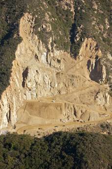
14) The crushing and spreading of concrete throughout the site poses environmental hazards for human health and river ecosystems.
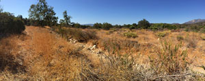
The proposed crushing of existing concrete pads, and of the existing previously removed concrete stockpiles could be environmentally harmful for river ecosystems and human health.
The crushing will put particulates in the air that could spread to the nearby river, river bike trail and residential areas. The concrete itself could be contaminated because it could have been used to cap, or bind contaminated soil, or it could have absorbed contaminants from being exposed to decades of petroleum/chemical refinery uses. Even if the concrete is miraculously free of all of the former refinery’s known human and environmental toxic contaminants that have been identified in/on the soil or leaching into the groundwater under the Petrochem site (such as but not limited to: benzene, ethylbenzene, toluene, polycyclic aromatic hydrocarbons (PAHS), polychlorinated biphenyls (PCBs), methyl tert-butyl ether (MTBE), lead, chromium lll and Vl, dichloro-diphenyl-trichloroethane (DDT), and asbestos), crushing and distributing concrete as a road base throughout the project site will potentially silt and contaminate the river with concrete particulate when the particulate dust settles on the river surface and/or crushed particulate is washed into the river during rain of flood events.
15) Construction, oil field equipment storage and maintenance will augment contamination. The project proposes potentially cumulatively compounding site contamination by allowing continuing polluting uses like oilfield equipment storage and maintenance on the site. Oilfield equipment storage/maintenance is associated with these types of potential contaminants: toxic metals, petroleum solvents, chlorinated solvents, semi-volatile hydrocarbons, and polychlorinated biphenyls (PBCs). The project proposes uses that continue to contribute to the cumulative pollution on the Petrochem site.
The highly contaminated Petrochem site has never been cleaned to the background levels like those the site had before the former oil and chemical refinery facilities polluted the site. Although the landowner has participated in a Voluntary Cleanup program where there has been some surface level cleaning, and some cleaning of some of the underground contamination discovered after tank and building removals, there are still portions of the site (according to the 2017 Dudek letter in the staff report ) that still contain known toxic contamination. It should be noted that multiple contaminants remain to date on/under the project site and not just on/under the 10.7 and 0.5 acres not-for-use portions of the site that still have the two spherical tanks.
The remaining contamination on the for-use and the not-for-use portions of the site is of major concern because of the site’s location adjacent to the river, and in the river’s known floodplain, and in close proximity to the Canada Larga and Manuel tributary confluences which makes contaminant-transfer to the river much more likely.
16) Environmental Justice for the nearby community has not been considered.
The partial contamination clean-up which has been accomplished to date has been supervised by the USEPA and the SWRCB. The State Water Board’s involvement in the process points to the concern that groundwater and/or surface water could potentially become contaminated by substances found on this property. Groundwater and surface water contamination could potentially affect human and ecosystem health, raising concerns of environmental inequity and injustice.
The Avenue Area has a large population of minority and low-income persons. Environmental inequity is described by the Environmental Protection Agency (EPA) as the distribution of environmental public health exposures and risks that disproportionally affect minority and low income populations (EPA 2009).
Environmental justice ensures that people of all socioeconomic backgrounds live, work, and play in healthy environments (EPA 2009). Limited access to recreational open space and a high number of contaminated sites indicates a challenge to create greater environmental equity in the Avenue and North Avenue areas.
17) CEQA requires that alternative uses be examined by the Planning Department. This was not done, although a viable alternative use has been proposed.
The 2008 Lower Ventura River Parkway Plan is a vision plan for the lower Ventura River area. While it is not an officially adopted plan, both the Ventura County Board of Supervisors and the Ventura City Council did endorse the Plan’s river restoration concept.
The Plan’s Purpose reads: “The California River Parkways Act of 2004 and related legislation provides for the establishment of river parkways on lands along rivers or streams. The purpose of river parkways include the protection and improvement and restoration of riverine and riparian open space and wildlife habitat, the provision of opportunities to the public for recreation as well as awareness regarding the conservation of existing developed riverfront land uses into uses consistent with river parkways. This document envisions a plan for a river parkway along the lower Ventura River. The proposed Lower Ventura River Parkway is approximately six miles in length, beginning at the Pacific Ocean and ending upstream at Foster Park.”
It continues: “This document is intended as an analysis, planning, and design tool for government and non-government agencies and the surrounding community who are interested in creating a river parkway that is compatible with recreational use, stewardship, river function, and regional ecosystems.”
Under “Goal” the Plan states: “The project goal for this Vision Plan is to reconnect people to the Lower Ventura River by providing opportunities for recreation, education, and stewardship while protecting and enhancing hydrological and ecosystem resources.”
Under “Objectives” the Plan lists:
- preserve and expand space for natural river function
- mitigate the impact of hydrological structures on river function and ensure adequate instream flow
- protect parkway structures and activities from flood damage
- improve the quality of surface and groundwater
- restore and enhance ecosystems
- enhance biodiversity by reducing harmful impacts
- increase habitat connectivity
- manage invasive species
- improve access to and recreation at the river
- minimize incompatible land uses near the river and increase cultural awareness of the river through formal and informal education opportunities
- encourage stewardship of the river
Later it states: “A successful river parkway project on the lower Ventura River can serve as the backbone of environmental infrastructure for the lower watershed for the next century, inspiring the community to value river restoration, protection of ecosystems, access, stewardship, and economic development.”
In conclusion, Appellants ask that the Planning Commission refuse to allow the continued degradation of the Petrochem project site by continued and expanded oilfield uses under the umbrella of a contractor equipment storage and maintenance yard. This use should be rejected. It is not honoring the words or the intent of the City and County General Plans. It is not honoring the river restoration concept that the Board of Supervisors and the City Council endorsed after the 2008 Lower River Parkway Plan was completed, and before the Ventura River Parkway Trail became one of only about 1500 National Recreation Trails (NRT) in 2014.
Page 123 of the Lower Ventura River Parkway Plan vision states: “With appropriate corrective action, including bioremediation and sustainable planning and development, underutilized and contaminated sites in close proximity to the Ventura River could provide a variety of uses. A vibrant urban environment connected to enriching recreational open space in natural settings can begin to stitch together an equitable distribution of healthy environments.”
We ask that you look forward toward river restoration –cleaning and correcting the past highly polluting uses on this site. We ask that you consider that this site is also bordered, in close proximity to the north and south, by the Canada Larga and Manual Canyon tributary confluences.
This river adjacent property, its surrounding natural environment, and its surrounding underserved community all deserve more than to allow this site to become a multi-acre parking lot, and contractor equipment/oil field equipment/boat storage and maintenance yard.
This is a unique site that has the River Parkway bike trail running through it. This site deserves to have its contamination remediated and thoroughly cleaned, and its sensitive river and tributary confluence adjacent location celebrated.
Finally, we request that this appeal be regarded as incorporating all prior submissions that are part of the record for this project, including oral and written comments made at public hearings.
For all of the above points of appeal and any others presented at the upcoming Planning Commission Hearing, or by other co-appellants as part of this appeal, the appeal should be granted, and the appellants’ request a full refund of their appeal fees.